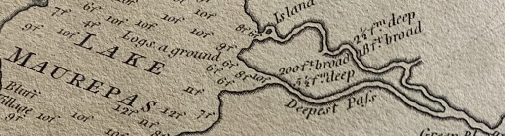
It can be said that Jones Island is the only island in Lake Maurepas. This part of the lake’s northeastern shore is completely encircled by water from the two tidal passes that flow to Lake Pontchartrain, some seven miles away. The passes are is actually fragments of the Tickfaw and Amite Rivers which were cut off by Lake Maurepas’ expansion during the past 2,000 years.
This British colonial map from the time England possessed Louisiana failed to note they had named the island between the passes after General Thomas Gage, commander of British forces in North America.
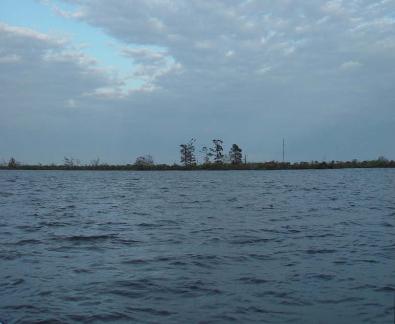
Part of Jones Island’s bleak western shore beckons visitors from a choppy Lake Maurepas.