
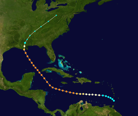
It wasn’t until the early Twentieth Century that warnings about weather events at sea could be quickly relayed from ship to shore by using the young technology of radio. There was yet any way to give much of an idea about how bad a storm might become or where it might go. In 1915, two hurricanes were reported going through the West Indian Islands and they ended up striking the US Gulf Coast with great severity. The first storm landed near Galveston, TX in mid August and killed over 300. (Their famous “big one” killed around 12,000 in 1900.) The second storm made land September 29 at Grand Isle, LA and killed 275 people altogether, mostly in southeast Louisiana. It had the highest winds and the lowest barometric pressure ever recorded for any hurricane up to that time and today would be rated as a strong Category 4. Its stronger east side racked up coastal delta communities in Plaquemines, St. Bernard and Orleans Parishes.
The devastation in Lower Plaquemines Parish was truly awful to those who witnessed the aftermath; worse than ever seen before or imagined possible. Very little was left of the communities of Venice, Buras, Myrtle Grove, Point A la Hatch and Boothville. Many smaller communities up and down the river’s banks were swept away, never to return; literally wiped off the map. Levees were breached and the low delta landscape was completely inundated. A ship’s Captain fortunate to have escaped the storm by finding refuge inside the mouth of the Mississippi reported he could not see the river’s banks or the surrounding marshlands for they had completely and horrifyingly disappeared beneath the inundation that melded river and ocean. Crops and livestock were drowned, farms, businesses and homes flattened or severely damaged, fishing boats, docks and livelihoods destroyed and people were lost in the flood
Afterward, officials and Good Samaritans penetrated the countryside as best they could by boat and rail but were hard pressed to provide enough assistance to the many people left alive and marooned on scraps of high ground or remaining structures. These miserable souls were destitute, with only the wet, tattered clothes on their backs, if that. Some had been hungry for days, nearly all food stores were ruined by the floodwaters. People were left to piteous begging from the river’s banks or took to rafts and skiffs to desperately assail any boat that passed, wailing for any scrap of food. A seasoned river pilot who had been on the river for decades reckoned the suffering he saw was worse than that from all the hurricanes he’d ever seen combined.
In upper Plaquemines Parish and Orleans Parish the severity of the damage along the river diminished somewhat, though wind damage was widespread and included collapsed buildings and church steeples. The cupola on top of the famous Presbytere next to St. Louis Cathedral on Jackson Square was sent crashing to the ground by the storm’s winds. The south shore canals of the city’s recently improved drainage system were overtopped and much of the city was flooded. But it was the storm’s six-foot high surge and attendant winds that did something strange and horrific in Lake Pontchartrain. It was turned into a cauldron and devastated unsuspecting communities around its shore.
Consider your comfortable, day to day surroundings and imagine how incomprehensible it must be to find what is taken for granted as safe, sensible, high and dry inexplicably altered by invading, raging water. For many in isolated villages and settlements around the lake who did not know what kind of storm was coming, this is what they found themselves unexpectedly immersed in that Thursday morning. The storm’s intense low pressure bowed up the lake’s surface and caught thousands of lakeside residents by surprise with high wind and water. (Something that some modern-day readers are unfortunately familiar with.)
Caroline Riddle, keeper of the New Canal Lighthouse at West End on the south shore was tending the light alone the night of the storm. She heroically stayed at her station and maintained the beacon so any unfortunate mariner caught out on the lake could find shelter in the canal. As the wind shrieked and the water rose, the shore disappeared under the rolling waves and Caroline and her tiny station with its blinking light were alone, surrounded by the dark, chaotic lake, the safety of the lakeshore impossible in the darkness. Though the building was badly battered, she persevered, survived the night and found her way back to dry land to relate her story.
Helen Schlosser, interviewed by local historian Wayne Norwood just days before her passing in 1990, recounted her harrowing tale of survival in the storm. She was 14 and remembered an idyllic life that was enjoyed by her family and friends before the storm. She lived on a farm on the Pontchartrain lakeshore on the edge of the swamp near the community of Wagram. It was one of a string of small farming hamlets alongside the railroad that followed the western shore of the lake from New Orleans to points north. Almost everything the family needed was provided by the farm and the woods and, if necessary, city and town were just a train ride away. Life was good; there was even a monthly community fais do-do to look forward to.
The wind had picked up overnight and rain pelted the roof as morning broke on the 30th, the lake began to incessantly explode against the shoreline bulkhead. By nine-o’clock lake-water surrounded the house and had reached the railroad. Shortly after, the lake began to pound the house. Helen’s father fought rising wave, wind and water to shepherd his family in their pirogue to the relative safety of the raised tracks. The wind and debris cruelly slapped them around, exposed as they were, until they struggled to find refuge with others at the nearby school house. There they prayed for their salvation until the lake’s rising waves began to tear that building apart. Just as Mr. Schlosser decided the only hope was floating his family in the pirogue deeper into the swamp they heard a train whistle above the howling rain and wind. The Hammond train took them and others onboard but the engineer found they were trapped between washed out sections of track. The crew and refugees then watched in horror as the peaking storm surge put two feet of water in the high rail car on the elevated tracks. They knelt in the water and prayed some more.
A similar drama unfolded on the east side of the lake where a train had risked entering the storm-wracked marshes in an attempt to rescue any who lived along those tracks. Unfortunately, the engineer on this train felt he could not chance losing all to the rising waters and had no choice but to withdraw and leave those remaining on this shore to their fates.
Helen went on to tell how other last-minute places of refuge in the lakeside communities were broken open by the storm and the people sheltering within them were either trapped or cast out into the storm-tossed water to struggle for survival.One man climbed to safety in a cypress tree only to helplessly listen to the screams of his friends as they succumbed, one by one, to the waves; one man, babe in arms, was lifted by the winds to oblivion, others held on to floating debris until they either could hold on no longer or were eventually rescued. Young Helen lost many of her friends, family and neighbors during that long day and into the dark night. Ironically, the next day dawned crystal blue, sunny, calm and fresh on a devastated world.
Just as the places along the Mississippi River in lower Plaquemines Parish had disappeared forever, so too were the communities of Wagram, Ruddock, Strader, Jena, Owl Bayou and Sharkey along the railroad track on the Isthmus of Manchac between Lakes Pontchartrain and Maurepas. The land was flooded, the crops and farms destroyed and the soil temporarily poisoned by salt. Too many had died and those left moved to Laplace, Ponchatoula and other more secure places. The land slowly healed back as inundated wilderness swamp and remains today largely desolate; the sweet sounds of a

The Schlosser home and the Schlossers (Helen is on the left).
There are several notable, watery landmarks in today’s southeast Louisiana cause by the Hurricane of 1915. Each has decidedly geometric shapes – the pond at Caenarvon, the Pen near Lafitte, Edward Wisner’s holdings in the northwest corner of the Labranche wetlands, the rice fields west of Madisonville and several others. These were near-sea level lands that were leveed, ditched and drained for large scale agricultural projects and had inadvertently subsided. The storm surge from the Hurricane of 1915 promptly and permanently put them underwater. Finding these features on a map was easy for Sue Hawes of the US Army Corps of Engineers who stated: “God does not make square ponds.”