
About the Friends of the Manchac Greenway
The Isthmus of Manchac was created by a northward distributary of the Mississippi River delta as it laid down Louisiana’s River Parishes some 4,000 years ago. The two lakes that formed on either side of this landform continue to slowly expand. After generations of Native Americans occupied the land, the Americans built the first thoroughfare on the Isthmus in 1854 – the New Orleans, Jackson & Great Northern Railroad. The first highway, the New Orleans-Hammond Highway was built in 1927 and US 51 (now the official Manchac Greenway) was built to replace it 1961. These roads were again replaced by the adjacent Interstate-55 in 1978. They all travel in a twenty-three mile long intrastate transportation corridor through the wetlands between Laplace and Ponchatoula, LA. The only habitations along the way are the tiny villages of Frenier near Laplace and Galva and Akers on either side of Pass Manchac.
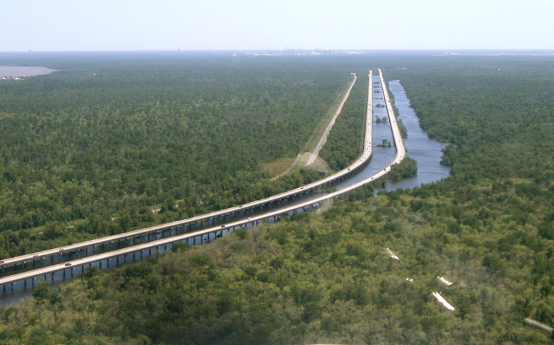
Looking south toward the industries on the Mississippi River, the community of Frenier on Lake Pontchartrain, where the Canadian National Railroad passes, is visible on the left . The Isthmus of Manchac Transportation Corridor is (left to right) – the old New Orleans – Hammond Hwy., old US 51 / Manchac Greenway, I-55 Borrow Canal Spoil Bank (under upland trees) and Interstate 55 and the I-55 Canal.
hese road projects and their maintenance have changed the hydrology and ecology of the isthmus.
Ecologically, the Greenway is radically different from the surrounding swamps and marshes and has plant life that doesn’t normally grow here. Ironically, trees like Hackberry, Elm, Oak, Swamp Maple and Black Willow are much the same species as found on old, meandering natural Mississippi River levees and shoreline Cheniers (beach ridges) across south Louisiana’s coastal wetlands. Even the remaining original “natural” waterways and wetlands on either side of the transportation corridor are not the same as when the Europeans found them three centuries ago. There has been wholesale, industrial logging of the original cypress forest and some of these did not completely regrow because man-made Mississippi River levees cut off nourishing spring overflows. The regrowth of the swamps near Manchac’s two tidal passes were stunted by saltwater intrusion in the Pontchartrain Basin and this has helped convert them to brackish marshes. The wide I-55 borrow canal the length of the isthmus makes the wetlands on either side much more accessible and susceptible to outside influences like salt water and invasive species of plants and animals and local drainage is greatly influenced by canals and cross-ditches.
Fortuitously, the two older road beds and the dredge-spoil bank along the I-55 Canal are elevated, aereated earthen structures – levees – with a blanket of rooted vegetation. Add rock armoring on the lakeshore and the entire Isthmus works as a “Coastal Line of Defense” protecting Lake Maurepas and its fragile wetlands.
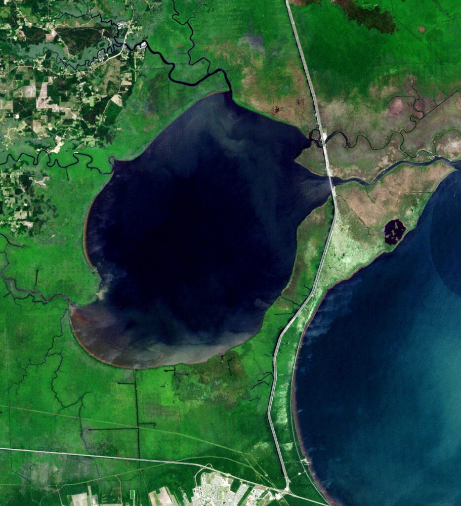
Landsat image by NASA
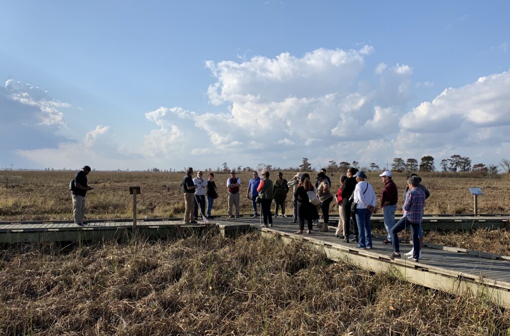
The Manchac Greenway already has a long history of being a recreational asset to the community:
Since US 51 was officially combined with the elevated I-55, the older ground-level roadway was officially designated an ancillary “Frontage Road” and became much less used. The older N.O.- Hammond Hwy. had been long abandoned. After having had such useful and busy pasts, these now often empty roads continue to be surrounded by scenic beauty, wildlife and history and have many convenient access points to wetlands and waterways. Indeed, since the first person parked their Model-T at one of the many drainage sloughs to wet a line, these roads have functioned as a greenway by providing the public with many and varied recreational opportunities like biking, walking, running, fishing, boating, sightseeing, etc. The use and improvement of these activities are what the Friends of the Manchac Greenway is all about.
The three raised roadbeds under the highways and railway and the interstate canal spoil bank act like levees and with additional rock armoring on the Lake Pontchartrain shore, plus a crown of steadfast vegetation, this landform is known as a “Coastal Line of Defense.” It not only protects the transportation corridor and the communities beyond, it is, indeed, the reason for the continuing existence of Lake Maurepas and the fragile fresh-water wetland ecologies in the upper part of the Pontchartrain Basin, protecting them from much of the salt water creeping in from the sea. Advocating the protection of the isthmus is a major goal of the Friends of the Manchac Greenway.
ABOUT THE FRIENDS OF THE MANCHAC GREENWAY
The Friends of the Manchac Greenway was established in 2014 as a non-profit (IRS 501c3) citizen’s group made of folks from St. John the Baptist and Tangipahoa Parishes. We have worked with parish and state governments and many others in the community to see that the isthmus is preserved and the Greenway is enhanced to realize a fuller potential as a true cultural asset and economic engine.
The Friends have a controlling Board of Directors, an Advisory panel and a representative under contract to promote our aims. We generally meet monthly at a predetermined location on the Greenway when meeting minutes are recorded for distribution to our membership and partners. Funding has been by membership dues and corporate donations. Our strategy has been to locate and contact any and all parties concerned with the Greenway and what it should and could be. We seek useful partnerships with any all to leverage what we can to see this project through.
CONTACT US
Web Address: http://www.manchacgreenway.org
Social Media: Facebook, Instagram, Twitter.
Mailing Address: P.O. Box 835, Laplace LA 70069
e-Mail Address: manchacgreenway@gmail.com
Friends of the Manchac Greenway Mission Statement
“The Friends of the Manchac Greenway was founded to protect and preserve the Manchac Greenway as a natural and recreational resource through advocacy, conservation and education.”
– Adopted 04/18/18