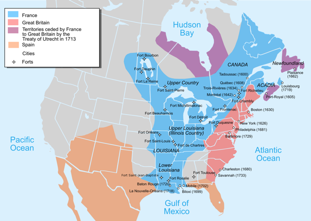
International claims in North America (courtesy Wikipedia). Note: The blue French claim in the Mississippi Valley to the Gulf of Mexico could be made after Iberville found the Mississippi River from the sea in 1699.
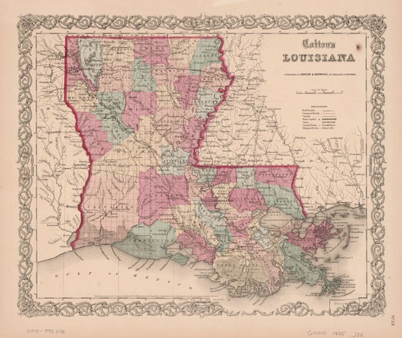
1855 (?) map of Louisiana. Note: Tangipahoa Parish was created in 1869 during Reconstruction by taking land from the four surrounding parishes. At this time, Republican (Unionist) control of the state was slipping away to Democratic (local) interests and this new parish would control prime territory with a north-south railroad and its attendant economic power.
Original Intentions: At first, the English and then their American offspring would not stay put in their growing former Atlantic colonies as they relentlessly moved west to eventually encroach on lands Spain had attempted to claim.
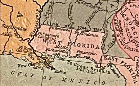
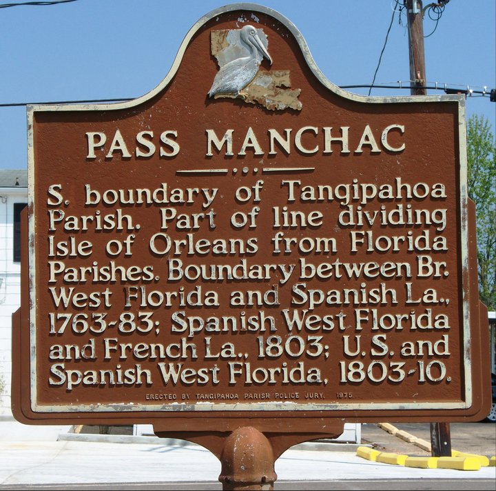
Bayou Manchac/Amite River/Pass Manchac/Lakes Maurepas and Pontchartrain would act together as an international boundary between Spanish, English, West Florida and American interests.
The Manchac Greenway crosses Pass Manchac, a channel that has been used as a boundary many times in Louisiana’s history including:
– Iberville’s 1699 journey of discovery on the Mississippi River went down Bayou Manchac to the Amite River, crossed Lake Maurepas, went down Pass Manchac, crossed Lake Pontchartrain to the sea and encompassed the imaginary but historically important “Isle of Orleans.”
– The Pass was used by the European powers competing in the region, France, Spain and England, as a boundary-line between their colonial holdings and later separated Spanish territory from American possession.
– It is the border between the historic and culturally different Louisiana regions of the Florida Parishes and the River Parishes and a political boundary between Tangipahoa and St. John the Baptist Parishes.